")
Αξίζει να επισκεφτώ
Spilios Agapitos refuge - Plateau of Mouses through "Kofto".
- Porfillidou Ioanna
- Mount Olympus
Route length: 2,8 km
Duration: 2 hours
Ascent: 620 meters Descent: 44 meters
Route description: Ascent-Difficulty: Very difficult
Recommended to:individuals with great experience in mountain trails. You’d better ascend through zonaria to avoid any inconvenience
Season: May to October
* The information above is given to reach your destination.
It is considered a very difficult route. That’s why we won’t make a detailed description, as it isn’t necessary to include it in your repertoire, there is the trail of “Zonaria”, which will take you effortlessly to the Plateau of Mouses and the refuges on the summit, through “Kofto” which as its name indicates eases off the gradient and the ascent.
General Informations:
It is a route of 2,8 km total length all on path with altitudinal slope (ascent) of 620 meters. The duration of the trail is 2-2,5 hours. There are signs throughout the path, although the trail itself, because of its oddity and altitudinal slope, will make you lose your way than walk through it. After all, for the first 2 km you will encounter a part of the trail where snow is preserved (after a heavy winter), which is difficult to cross even in the summer. There is no mobile service through the path and in general it is considered a trail of medium difficulty and can be also crossed by young children, if being careful.
Useful Phone Numbers:
- European Emergency Number: 112
- Fire Brigade: 199
- E.K.A.V. (Ambulance Help): 166
- Health Center of Litochoro: +30 23523 50000
- Sp. Agapitos refuge: +30 23520 81800
All the above are summarized in the following chart:
Powered by Wikiloc
Click on the word “wikiloc” so you can store the route on a Garmin gps device or Androit or Smartphone device. You can also print the information without the illustrations shown below. The tracking of the trail was done using a 650t Montana gps device by Garmin.
In Particular:
After a good breakfast, start today’s adventure from the path starting right next to the pine at the yard of the refuge (at an altitude of 2.060 meters) behind the water fountain (Image 1)…
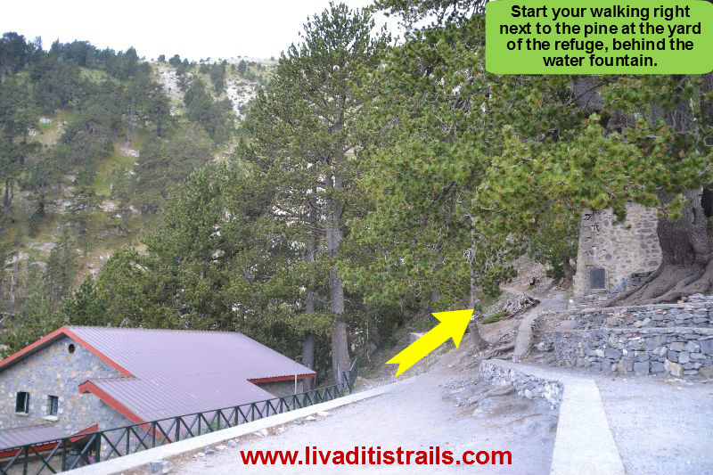 Image 1.
For the first 10 minutes, after 300 meters at an altitude of 2.140 meters, you will notice a crossroad on your right with signs that will guide you to the “Plateau of Mouses” and more specifically to the Ch. Kakkalos refuge. If you aren’t familiar with climbing we won’t recommend you follow this path, called “Kofto” due to its great slope and the remaining snow from the heavy winter. So, continue straight ahead (left) on the path (Image 2)…
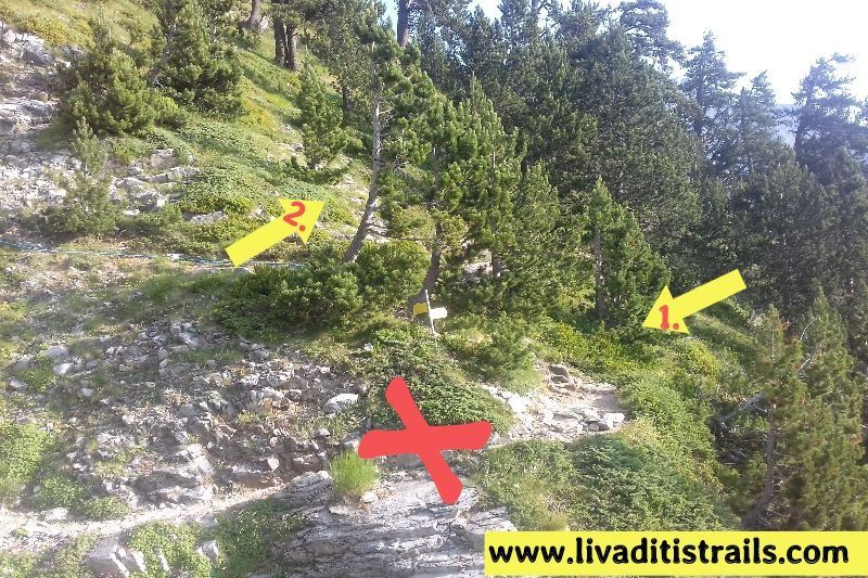 Image 2.
Follow the path which at the beginning is full of trees with a little slope…you will have the chance to witness Nature’s actions…pass through the area with the burnt by lightning logs, something like a tree graveyard (Image 3)…
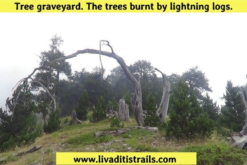 Image 3.
After passing by this “ugly” hillside of the mountain and after walking 1 km and 230 meters from the refuge, in about 45 minutes at an altitude of 2.240 meters, you will reach the difficult part of the trail especially if you choose to climb from May to June. There is a large “louki” (steep slope) where fallen snow from the winter is preserved and forces you to cross it. It isn’t easy to cross it even during summer, when the temperature is higher, and if you don’t have enough experience in climbing (Image 4)…
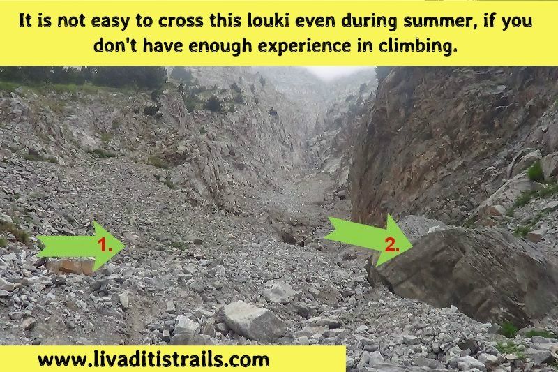 Image 4.
There have been many accidents due to lack of attention at this part of the trail, that’s why we insist on being alert all time to avoid any danger that may come up (Image 5)…
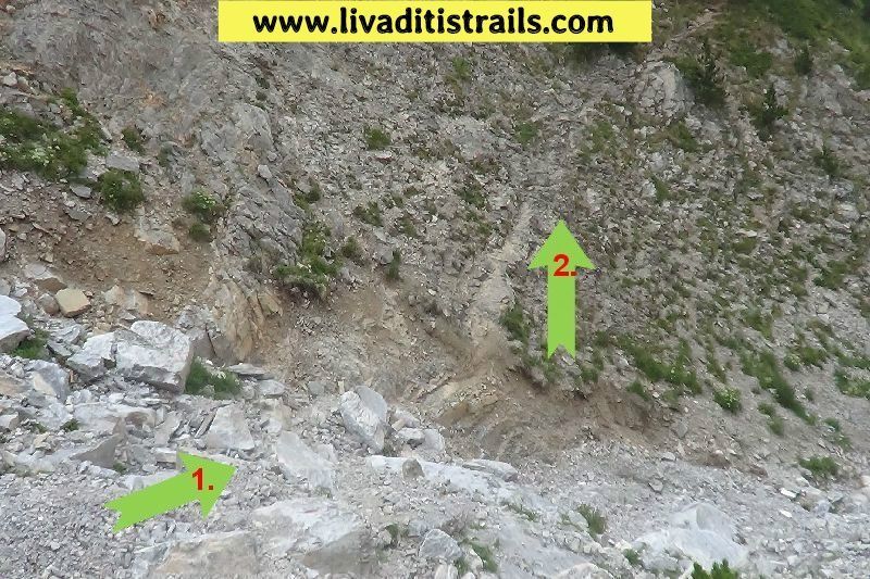 Image 5.
There are some detours on the main path because of landslides, so you must follow the sings through the trail. The sign below is aimed at those who descend from the Plateau of Mouses (Image 6)…
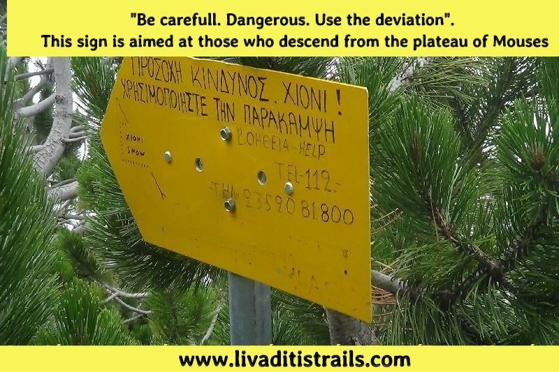 Image 6.
The great slope and the oddity of the rocks and the trail are the factors that make the rest of the route difficult… there are also rest points to catch your breath (Image 7)…
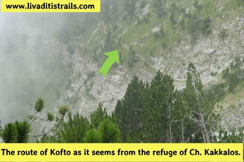 Image 7.
You will have to walk for 1,6 more kilometers after the “chionoura” in about 1 hour and 15 minutes to reach the “Plateau of Mouses”, you will notice (if there is no fog) the refuge of Ch. Kakkalos straight ahead at an altitude of 2.648 meters (Image 8)…
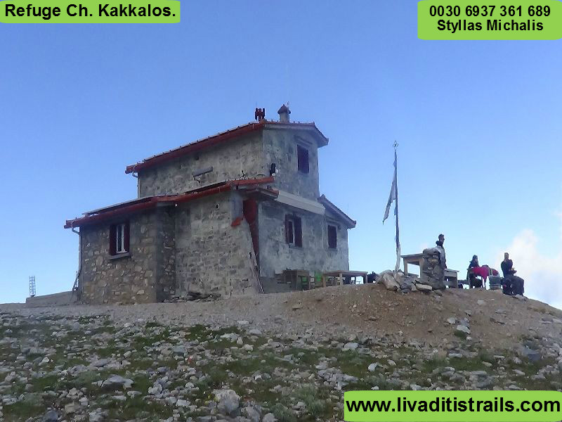 Image 8.
From now on you can follow your program, either stay at one of the refuges or continue to the summits. We mention again that if you follow this path (not recommended) be very careful.
The passage of the trail occurred on Tuesday 26th July 2016, the same day we gathered all the information that was mentioned, as well as the photographs included in the narrative of the path. We consider ourselves responsible, so we would like to treat those who love Nature and hiking and enjoy learning about new places with the same responsibility. We would also like, if you cross the trail above or any other on our website, to contact us (e-mail: Αυτή η διεύθυνση ηλεκτρονικού ταχυδρομείου προστατεύεται από τους αυτοματισμούς αποστολέων ανεπιθύμητων μηνυμάτων. Χρειάζεται να ενεργοποιήσετε τη JavaScript για να μπορέσετε να τη δείτε. ) whether we were accurate on our description or there was a flaw that should be corrected.
Thank you for your trust and for visiting our website!!!