")
(R. 7) Route 7: Refuges Ch. Kakalos and G. Apostolidis to summits of Toumba and Profitis Elias.
- Porfillidou Ioanna
Route length: 2 km (in total)
Duration: 1 hour and 15 minutes (in total)
Ascent: 300 meters (in total)
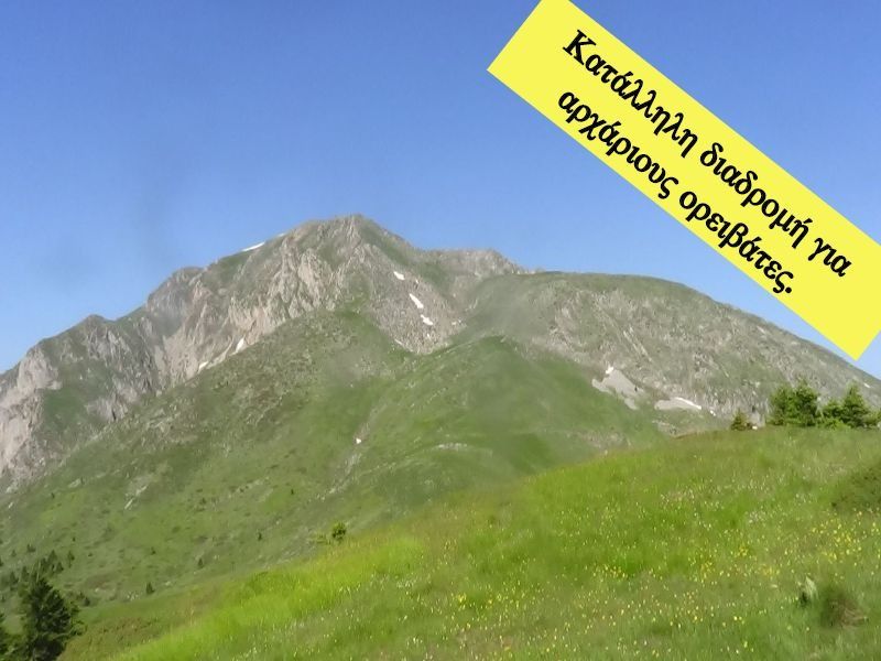
Route description: Ascent- Difficulty: Easy
Recommended to: all mountaineering clubs and if being careful to children above the age of 8 years old
Season: May to October
* The information above is given to reach your destination.
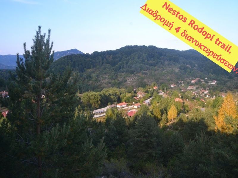
Two routes-summits which can be an excellent walk; if the weather is nice they can compensate you with a beautiful view, just above 2.800 meters. They might be a little unappreciated, because most people have in mind Mytikas (especially if you ascend for the first time), but you can easily understand the value of the summits after the second or third ascent to the Mountain of Gods. It will be a nice stroll and a recovery ascending to the summit, whether you stay at the Chr. Kakkalos refuge or the Giosos Apostolidis refuge. There is only one advice we would like to give you:
HINDER YOUR DESCENT… STAY AS LONG AS POSSIBLE!!!
The translation in English was made by " Sidiropoulou Athina " and we thank her, for her help.
General Informations:
The two routes are:
- Toumba Summit: Total length: 1 km (all on path), 138 meters of altitude, duration 30 minutes.
- Profitis Elias Summit: Total length: 1 km (all on path), 162 meters of altitude, duration 45 minutes.
There is definitely phone service on the summits; the routes are generally considered easy (of small difficulty degree).
Useful Phone Numbers:
-European Emergency Number: 112
-Fire Brigade: 199
-E.K.A.V. (Ambulance Help): 166
-GiososApostolidis refuge: +302351082840
-Chr. Kakkalos refuge: +306937361889
All the above are summarized in the following chart:
Powered by Wikiloc
Click on the word “wikiloc” so you can store the route on a Garmin gps device or Androit or Smartphone device. You can also print the information without the illustrations shown below. The tracking of the trail was done using a 650t Montana gps device by Garmin.
The route is also recommended by:
- Giosos Apostolidis refuge: +30 23510 82840/+30 6939 777 064 Tsavdaris Nikos/ +30 6948 043 655 Mpotelis Lazaros
- Chr. Kakkalos refuge: +30 6937 361 689 Styllas Alexandros
In Particular:
Route 1 (Plateau of Muses - Toumba Summit):
Start from the Chr. Kakkalos refuge (assuming you spent the previous night at the most relatively distant refuge at the Plateau) (Image 1)…
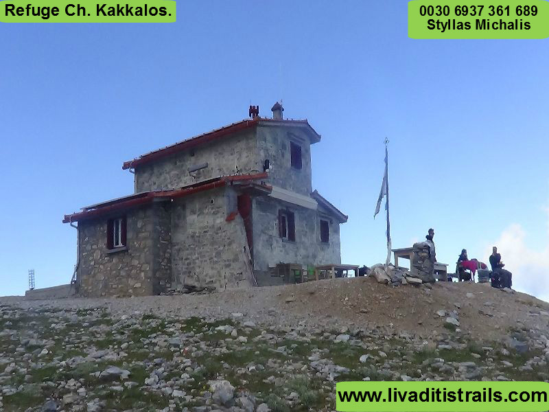 Image 1.
Following the path left by the refuge, you will arrive at the next refuge of Giosos Apostolidis in 10 minutes after 400 meters (Image 2)…
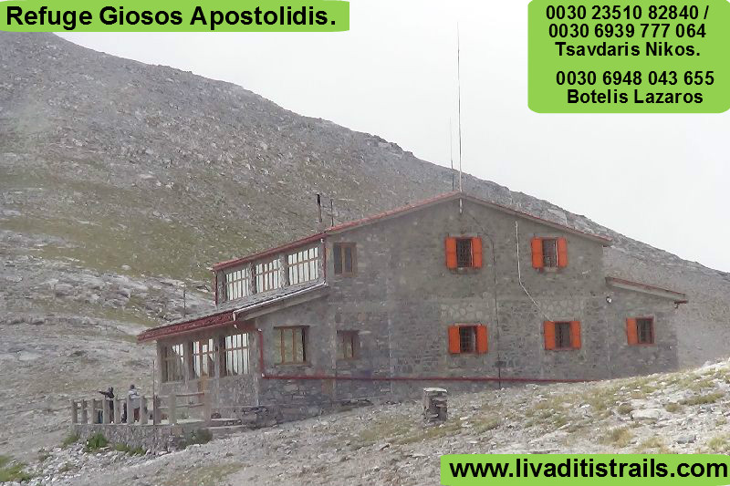 Image 2.
Go past the refuge and continue left towards the hillside to ascend to the summit (Image 3)…
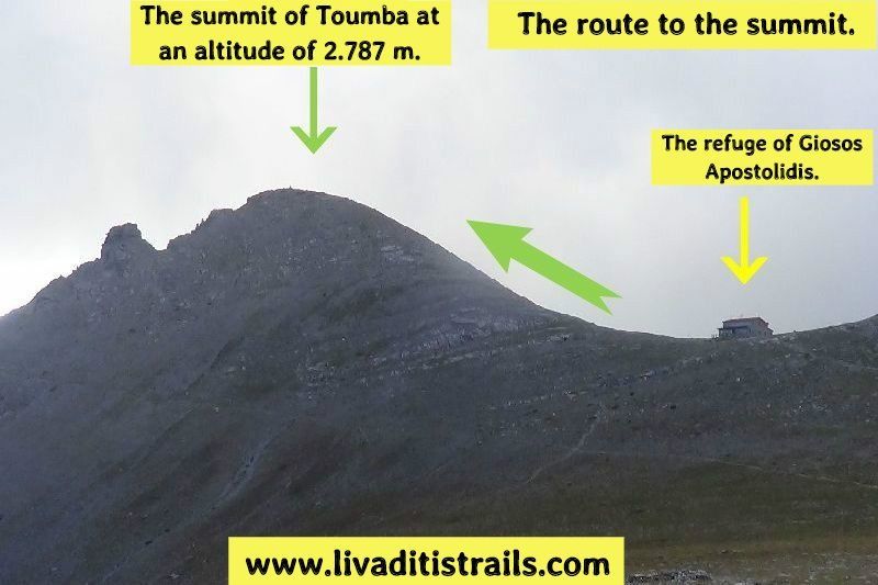 Image 3.
After walking 600 meters in about 20 minutes you will arrive at the Toumpa summit at 2.787 meters of altitude. Don’t look for a landmark; there isn’t one. If the weather is good enjoy the fantastic view (Image 4)…
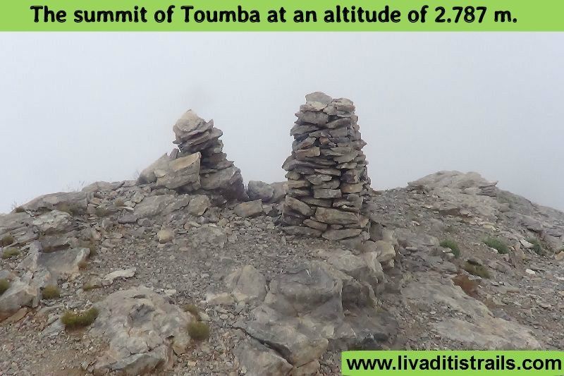 Image 4.
Generally speaking, both routes look like this (Image 5)…
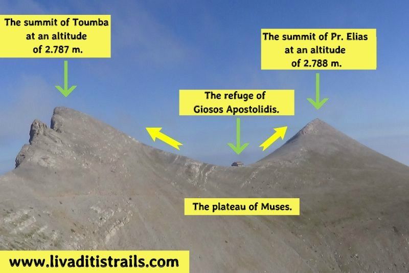 Image 5.
About the second route (Profitis Elias summit) the information mentioned above, are summarized in the following chart:
Powered by Wikiloc
Click on the word “wikiloc” so you can store the route on a Garmin gps device or Androit or Smartphone device. You can also print the information without the illustrations shown below. The tracking of the trail was done using a 650t Montana gps device by Garmin.
Route 2 (Plateau of Mouses - Profitis Elias Summit):
Start from the Chr. Kakkalos refuge (assuming you spent the previous night at the most relatively distant refuge at the Plateau) (Image 6)…
Image 6.
Following the path left by the refuge, you will arrive at the next refuge of Giosos Apostolidis in 10 minutes after 400 meters (Image 7)…
Image 7.
This time go right by the refuge to find the path that leads to the Profitis Elias summit (Image 8)…
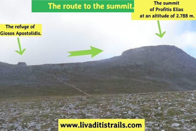 Image 8.
At the bottom of the summit you will meet mountain sheep, mostly in the afternoon (Image 9)…
 Image 9.
…and the view will amaze you, while ascending (Image 10)…
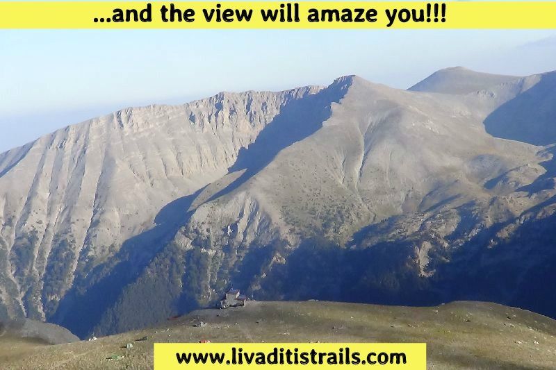 Image 10.
Finally, when you reach the summit, after walking 600 meters in 35 minutes, you will come across the highest church in our country, dedicated to Profitis Elias at an altitude of 2.788 meters (Image 11)…
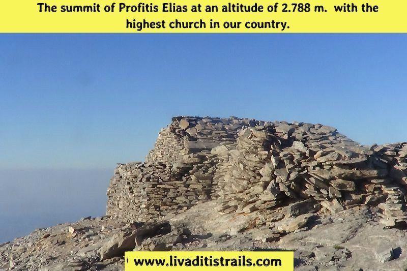 Image 11.
As the description of these important summits is completed, we definitely recommend to include them on your “personal summit list”, since they are considered an integral part of our history.
The passage of the trail occurred on Friday 26th August 2016 alongside with the friend and co-mountaineer Kyriakos Ioannidis; the same day we gathered all the information that was mentioned , as well as the photographs included in the narrative of the path. We consider ourselves responsible, so we would like to treat those who love Nature and hiking and enjoy learning about new places with the same responsibility. We would also like, if you cross the trail above or any other on our website, to contact us (e-mail: Αυτή η διεύθυνση ηλεκτρονικού ταχυδρομείου προστατεύεται από τους αυτοματισμούς αποστολέων ανεπιθύμητων μηνυμάτων. Χρειάζεται να ενεργοποιήσετε τη JavaScript για να μπορέσετε να τη δείτε. ) whether we were accurate on our description or there was a flaw that should be corrected.
Thank you for your trust and for visiting our website.