")
(R. 8) Route 8: Refuge Spilios Agapitos to summits of Skala - Skolio - Ag. Antonios.
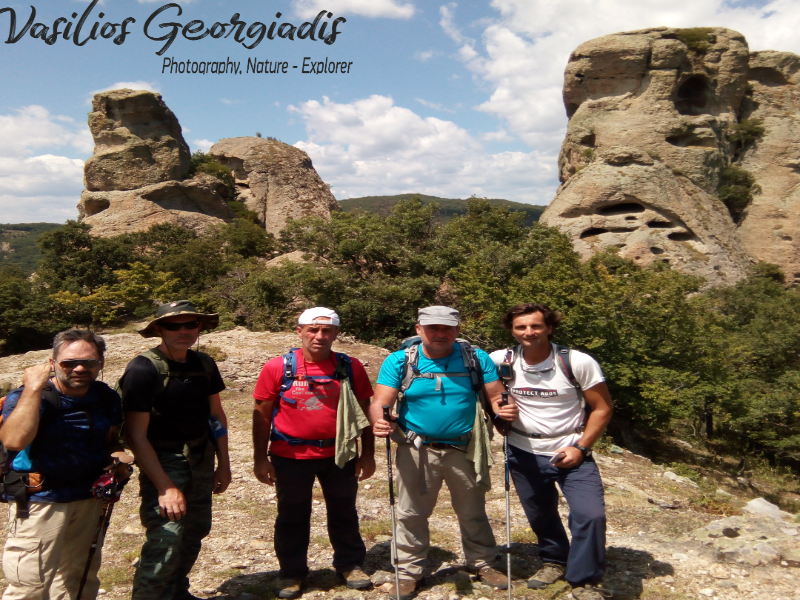
- Georgiadis Vasilis
Route length: 5,7 km
Duration: 3 hours and 30 minutes
Ascent: 854 meters - Descent: 223 meters
Route description: Ascent- Medium difficulty
Recommended to: all mountaineering clubs and if being careful to children above the age of 8 years old
Season: May to October
* The information above is given to reach your destination.
You have finally taken the decision to spend a night at Sp. Agapitos refuge and you enjoyed it. The next morning, you wake up thinking where to go to gain much more experience from Olympus, the Mountain of Gods. Firstly, you should reach for the refuge administrators (Dionysis and Maria), who will guide you about what to do next. Depending on your physical condition and whether you liked the mountain or not, they will organize a schedule for you. After all, you had already had a taste of Olympus after having completed the first 6 km of the Prionia - Sp. Agapitos refuge . We have already recommended the route for Toumpa Summit and Profitis Elias Summit, if you decide to walk through the route described below, you are probably ready for the next step in mountaineering: an ascent to the highest summit of Olympus, Mytikas.
Enjoy every moment of your stay on Olympus. There are so many recommendations to follow. It is certain that the mountain will win a place in your heart an (when the time comes) you will leave with nothing but the best impressions.
The translation in English was made by " Sidiropoulou Athina " and we thank her, for her help.
Information:
It is a route of 5,7 km total length, all on path, with altitudinal slope (ascent) of 854 meters. The duration of the trail is 3 hours and 30 minutes. There are no signs through the trail but the path is very distinct while at crossroads there are signs which inform you where each path leads and which you should follow to reach your destination. Throughout the path there is no mobile service, only on the summits. In general, it is described as a route of medium difficulty and with a little attention it can be crossed by young children.
USEFUL PHONE NUMBERS:
-European Emergency Number: 112
-Fire Brigade: 199
-E.K.A.V. (Ambulance Help): 166
-Sp. Agapitos refuge: +302352081800
All the above are summarized in the following chart:
Powered by Wikiloc
Click on the word “wikiloc” so you can store the route on a Garmin gps device or Androit or Smartphone device. You can also print the information without the illustrations shown below. The tracking of the trail was done using a 650t Montana gps device by Garmin.
The route is recommended by the administrators of Spilios Agapitos refuge.
In particular:
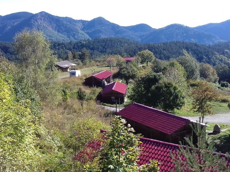
After a good breakfast, start today’s adventure from the path starting right next to the pine at the yard of the refuge (at an altitude of 2.060 meters) behind the water fountain (Image 1)...
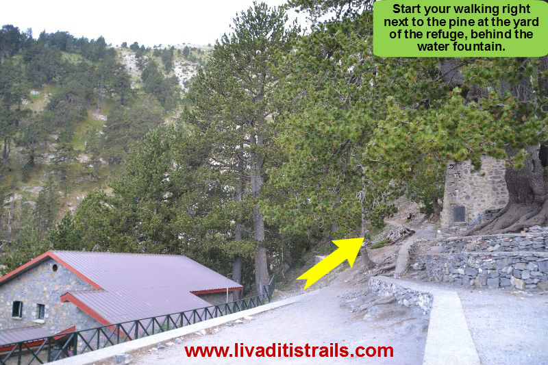 Image 1.
For the first 10 minutes, after 300 meters at an altitude of 2.140 meters, you will notice a crossroad on your right with signs that will guide you to the “Mouson Plateau” and more specifically to the Ch. Kakkalos refuge. If you aren’t familiar with climbing we won’t recommend you follow this path, called “Kofto” due to its great slope and the remaining snow from the heavy winter. So, continue straight ahead (left) on the path (Image 2)…
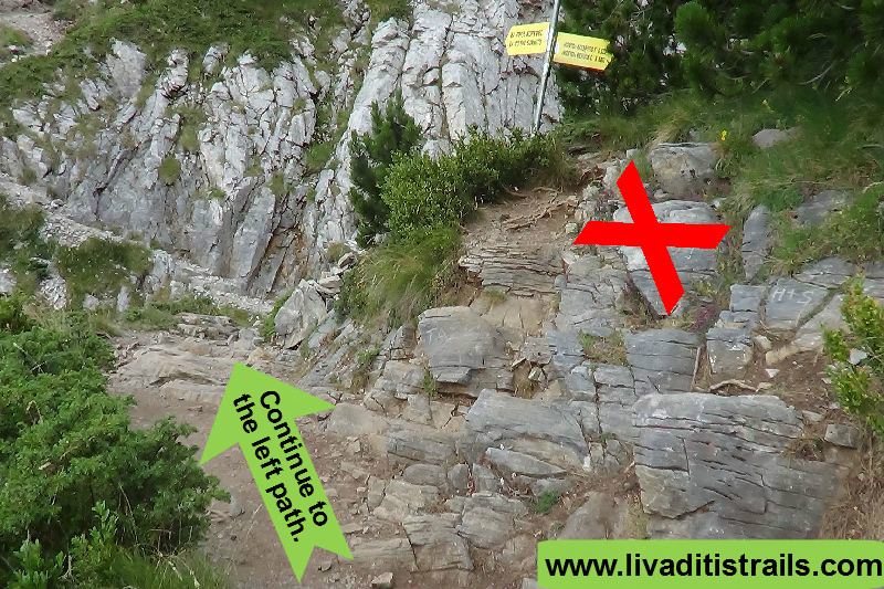 Image 2.
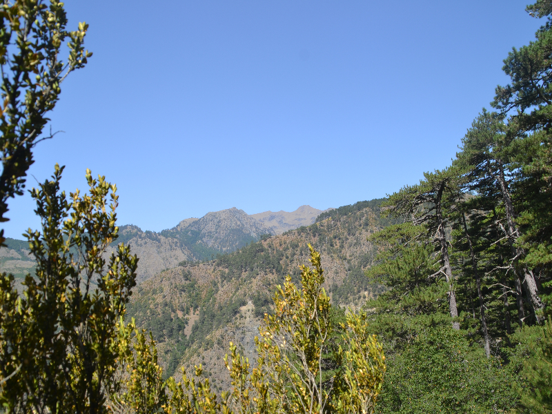
After 400 meters and 15 minutes of walking at an altitude of 2.220 meters, you will come across a bench made of stones; you have an amazing, panoramic view of “Kalogeros” and “Livadaki” summits (Image 3)…
 Image 3.
Continue on the path, after 600 meters and 30 minutes of walking at an altitude of 2.420 meters, you will come across a second bench with the same panoramic view (Image 4)…
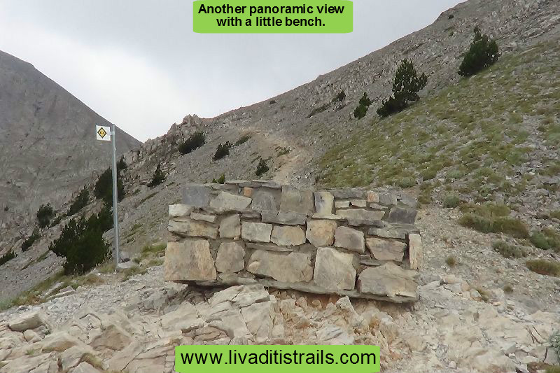 Image 4.
The edge behind the bench is the crossroad to “Skala” or “Zonaria”, where you will arrive after 200 meters of walking (about 10 minutes) at an altitude of 2.480 meters. At the crossroad continue straight ahead (left) at the bottom of a large slope, which leads to the most important summits of Olympus (Image 5)…
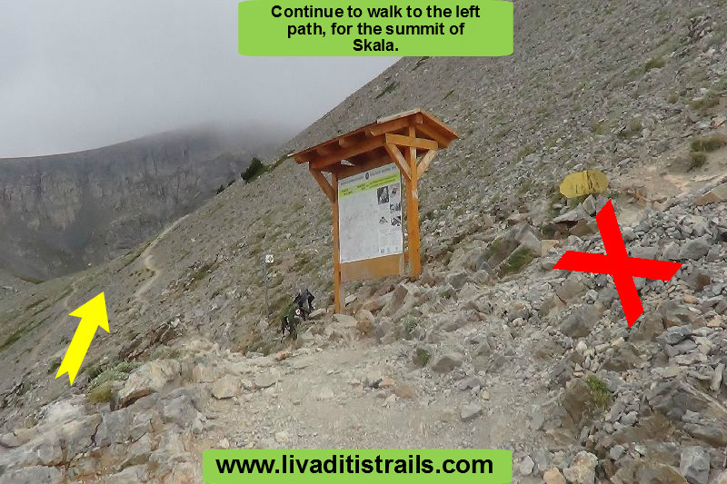 Image 5.
The next 1,2 km may be the most difficult part you have ever walked in your life. The slope is endless and combined with your eagerness to reach higher altitudes for the first time, it will seem almost impossible (Image 6)…
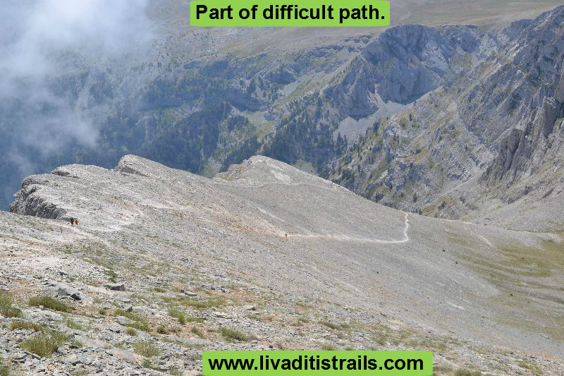 Image 6.
Don’t worry though! You will manage to walk this part with a slow walking pace and right breathing (left foot first, inhale, right foot then, exhale) now you will start approaching today’s first goal (Image 7)…
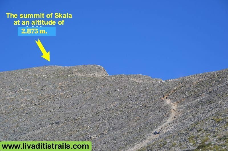 Image 7.
The view seen in a few minutes, after reaching “Skala” summit at an altitude of 2.875 meters, will be striking. From the crossroad, you will have to walk 55 minutes more to cross the last 1,5 km to the summit. There is no landmark, because it was slowly torn apart by the wind (Image 8)…
 Image 8.
You can rest for a while and catch a few breaths after ascending (it wasn’t that difficult after all) and then continue to your second goal for today. Remember that if you want to reach “Skolio” summit, the second highest summit in our country, you can continue walking on the mountain ridge. The summit is visible from your current position (Image 9)…
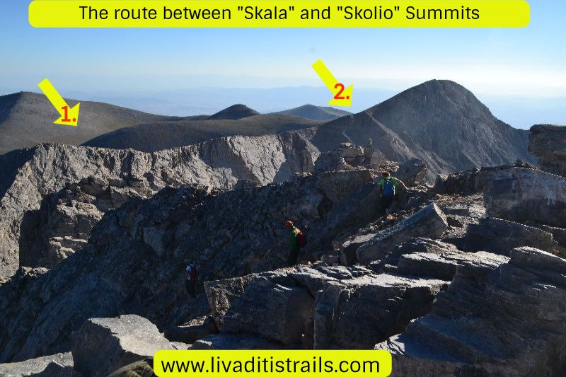 Image 9.
Later, as you approach, you can descend a little left only to find the path which will help you ascend the last slope to reach the summit (Image 10)…
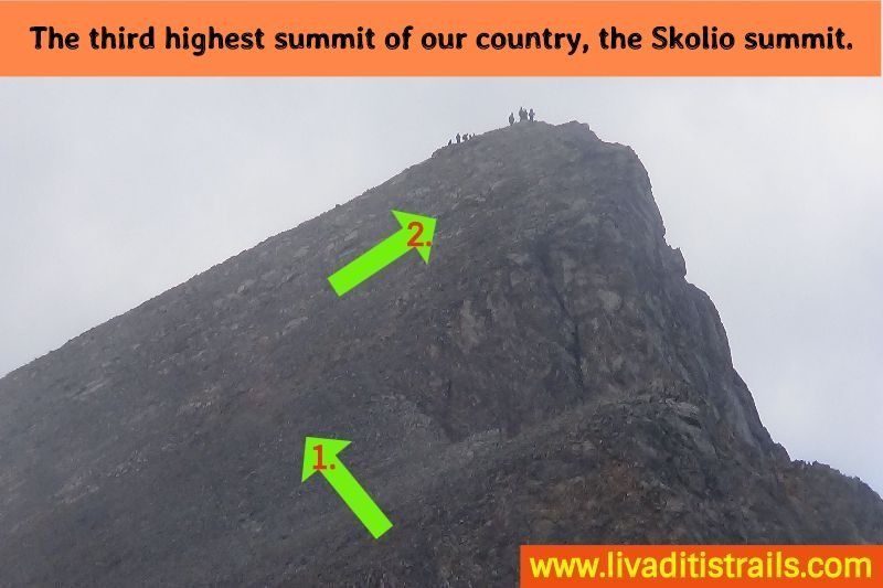 Image 10.
You will have to walk 800 meters more in half an hour and 70 meters altitudinal to reach “Skolio”, the third highest summit in our country, at an altitude of 2.905 meters (Image 11)…
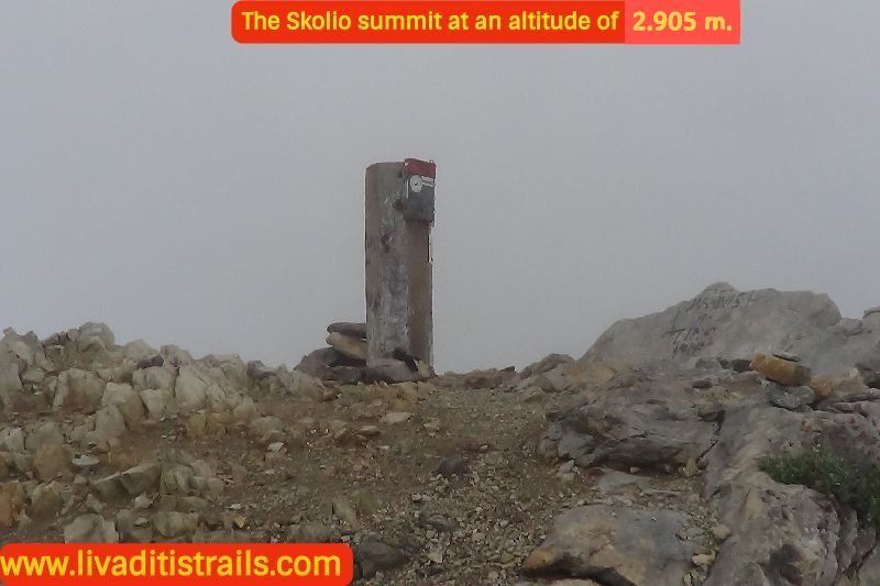 Image 11.
The weather changes at this altitude are unique. The weather can instantly change from sunny to rainy. You will be amazed by how fast these changes happen. That’s also the reason you should be prepared and well-equipped to deal with any situation.
Let’s go back to the narrative. Next on our schedule today is a third summit, Agios Antonios. From Skolio you will notice a path descending straight ahead and which you must follow. At a certain point, you will come across metal columns with O2 signs on them. If the weather is good, the path will be clearly visible. But, if the weather if foggy or rainy, you will have to be very careful to follow these signs to reach the summit (Image 12)…
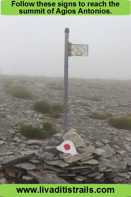 Image 12.
The trail goes under a hill and then ascends until you reach the Ag. Antonios summit (Image 13)…
 Image 13.
Keep the route in your mind like this… descending from Skolio to a flat headland, you will notice the O2 sings, then continue straight ahead and under a hill, which later ascends until the summit (Image 14)…
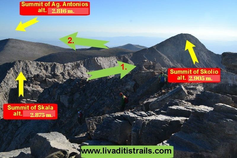 Image 14.
From Skolio to Ag. Antonios you will walk 2,2 km in about 1 hour and 90 meters altitudinal. In total, from Sp. Agapitos refuge you will complete 5,7 km in 3,5 hours. They might seem a lot and quite hard, but they worth it and you will definitely enjoy it (Image 15)…
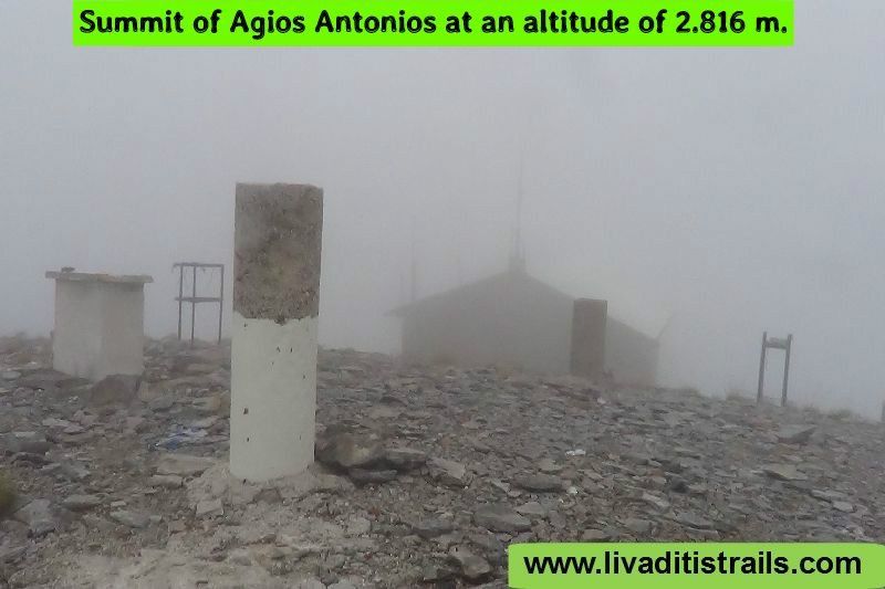 Image 15.
Just for your information: at Ag. Antonios summit, there is a building used as a meteorological station, but most importantly as an emergency refuge. When you enter and go up the stairs, where used to be the main door, you will find all the necessary items you will ness in case of an unexpected weather change (Image 16)…
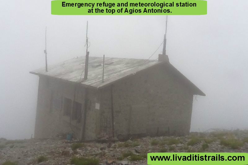 Image 16.
For the return, follow the same path from which you reached the summit…
The passage of the trail occurred on Tuesday 27th July 2016; the same day we gathered all the information that was mentioned, as well as the photographs included in the narrative of the path. We consider ourselves responsible, so we would like to treat those who love Nature and hiking and enjoy learning about new places with the same responsibility. We would also like, if you cross the trail above or any other on our website, to contact us (e-mail: Αυτή η διεύθυνση ηλεκτρονικού ταχυδρομείου προστατεύεται από τους αυτοματισμούς αποστολέων ανεπιθύμητων μηνυμάτων. Χρειάζεται να ενεργοποιήσετε τη JavaScript για να μπορέσετε να τη δείτε.) whether we were accurate on our description or there was a flaw that should be corrected.
Thank you for your trust and for visiting our website.