")
Refuge "A" or "Spilios Agapitos" - "Petrostrougas" refuge.
- Georgiadis Vasilis
- Mount Olympus
Route length: 8,3 km
Duration: 3 hours
Ascent: 344 meters Descent: 482 meters
Route description: Ascent- Medium difficulty
Recommended to: all mountaineering clubs and if being careful to children above the age of 8 years old
Season: May to October
* The information above is given to reach your destination.
It is considered a convenient route concerning the mountain trails you want to cross. Most times the place where you park your car, at Prionia or at “Gkortsia”, is binding for the route you will follow on the mountain. In case you park at “Prionia”, you must ascend and descend from Spilios Agapitos to reach your car. If you park at “Gkortsia”, you will have to walk for 4 more kilometers on concrete road or hitch- hike to arrive at your car, which is quite inconvenient. The description below will resolve your problems, because it connects two well-known hillsides of the mountain. It is a new route which most people ignore but we think that it’s only a matter of time (maybe next year, in 2017) to become widely known. The alternatives recommended by this route are many and adjustable to your program.
The translation in English was made by " Sidiropoulou Athina " and we thank her, for her help.
Information:
It is a route of 8,3 km total length, all on path, with altitudinal slope (ascent) of 344 meters and descent 482 meters. The duration of the trail is 3 hours. There are sings throughout the trail while at crossroads there are signs which inform you where each path leads and which you should follow to reach your destination. Throughout the path there is mobile service in certain points. In general, it is described as a route of medium difficulty and with a little attention it can be crossed by young children.
The route is also recommended by:
- Refuge "A" or "Spilios Agapitos" click on the link for more information (reservation number: 2352081800)
- “Petrostrougkas refuge” click on the link (reservation numbers: +30 2351200766 and +30 6977246350 Nektarios / +30 6948821513 Telemachus).
USEFUL PHONE NUMBERS:
European Emergency Number: 112
Fire Brigade: 199
E.K.A.V. (Ambulance Help): 166
Health Center of Litochoro: +30 23523 50000
Refuge "A" or "Spilios Agapitos": +30 23520 81800
All the above are summarized in the following chart:
Powered by Wikiloc
Click on the word “wikiloc” so you can store the route on a Garmin gps device or Androit or Smartphone device. You can also print the information without the illustrations shown below. The tracking of the trail was done using a 650t Montana gps device by Garmin.
In particular:
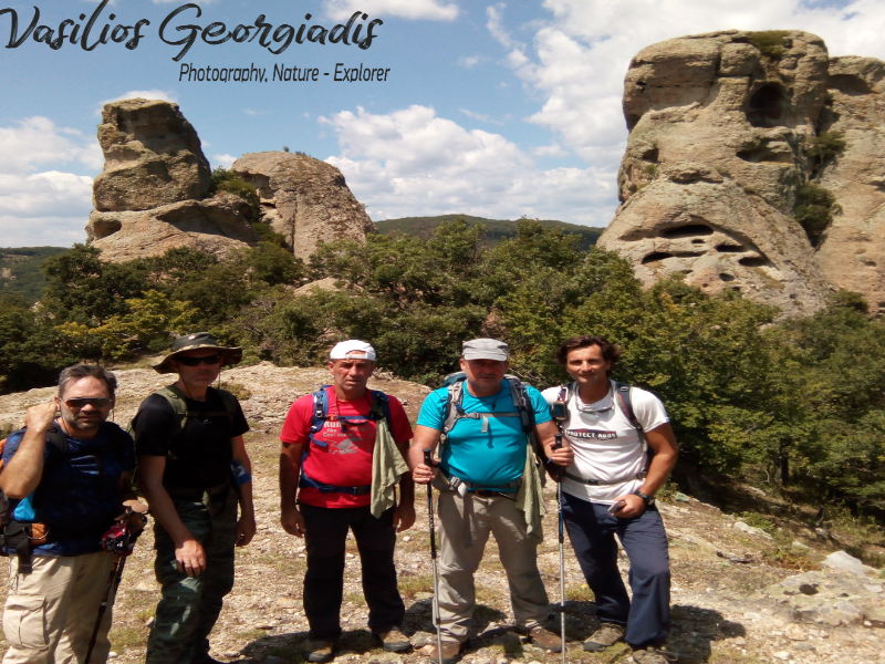
After a good breakfast, start today’s adventure from the path starting right next to the pine at the yard of the refuge (at an altitude of 2.060 meters) behind the water fountain. Basically, you follow the path from where you ascended from “Prionia” (Image 1)…
 Image 1.
After walking 2 km in about 40 minutes, you pass by “Kagkelia” (Image 2)…
 Image 2.
…and find yourselves at a forest part of the path; in about 300 meters you will come across a crossroad with small yellow signs. You are at 1.720 meters of altitude and you have to follow the left path.; don’t descend to “Prionia” (Image 3)…
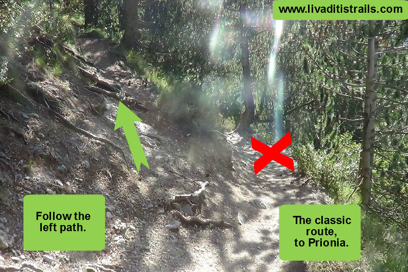 Image 3.
25 minutes later and after walking 1,5 km at an altitude of 1.775 meters, you will arrive at a clearing. On the trees opposite, there are signs which inform you that you must turn left to continue towards your destination, the “Petrostrougkas” refuge (Image 4)…
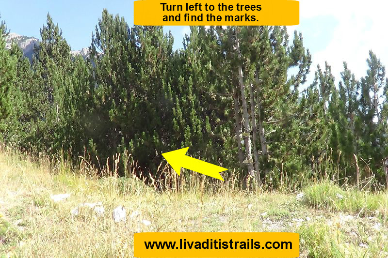 Image 4.
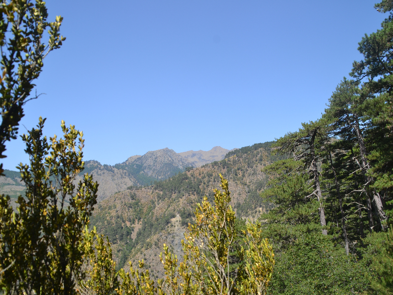
At this point, the sign informs you that on the hillside in front of you, the path ascends to “Gomarostali” plateau (Image 5)…
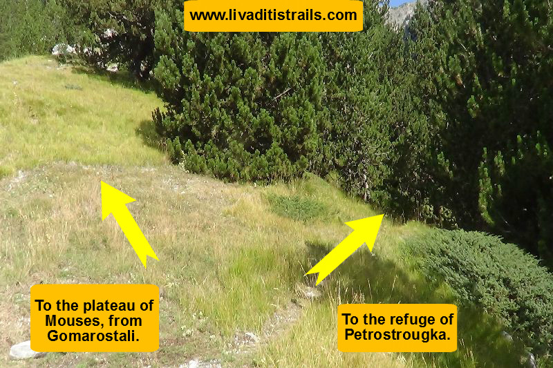 Image 5.
Continue on the path on your left for another 800 meters, for about 15 minutes at an altitude of 1.700 meters, where you will come across a new crossroad which notifies you that you have to turn left again to reach “Petrostrougkas” refuge, otherwise, if you change your mind and want to return to “Prionia”, go right for 2 km (Image 6)…
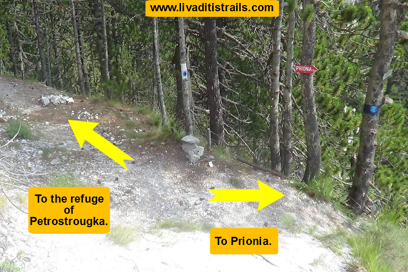 Image 6.
While crossing the path, the signs you will notice by one or by twos, are these below (Image 7)…
 Image 7.
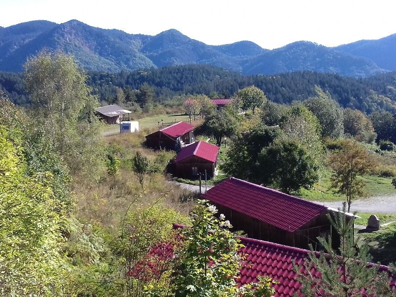
After the last crossroad, you will have to cross 4 more km, for about 1 hour and 40 minutes to reach “Petrostrougkas” refuge, having completed 8,3 km in 3 hours and from an altitude of 2.060 meters at an altitude of 1.925 meters (Image 8)…
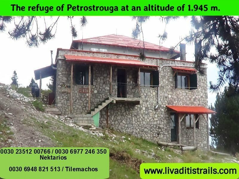 Image 8.
From now on you can follow your program. This route, as mentioned at the beginning, is going to be very popular next year and very convenient concerning the return to your car. It is an astonishing route, which provides another view of Mt. Olympus. We strongly recommend it.
The passage of the trail occurred on Sunday 28th August 2016 alongside with the friend and co-mountaineer Kyriakos Ioannidis the same day we gathered all the information that was mentioned, as well as the photographs included in the narrative of the path. We consider ourselves responsible, so we would like to treat those who love Nature and hiking and enjoy learning about new places with the same responsibility. We would also like, if you cross the trail above or any other on our website, to contact us (e-mail: Αυτή η διεύθυνση ηλεκτρονικού ταχυδρομείου προστατεύεται από τους αυτοματισμούς αποστολέων ανεπιθύμητων μηνυμάτων. Χρειάζεται να ενεργοποιήσετε τη JavaScript για να μπορέσετε να τη δείτε.) whether we were accurate on our description or there was a flaw that should be corrected.
Thank you for your trust and for visiting our website.