")
Length: 3 km and 800 meters.
Duration: 1 hour 30 minutes.
Altitude slope: 244 meters.
Route rating: Ascent - Easy
Recommended: In all mountaineering clubs, families and all ages.
Season: All year round, provided there are no snowfalls.
* The information listed above is just to go.
Perhaps, it is the easiest path in the region and more generally of mountainous Xanthi. However, it is not only a path that leads to an important altitude, but it also offers the opportunity to all family members to walk on a very nice and easy route that will thrill you.
The translation in English was made by "Fytopoulou Sofia" and we thank her, for her help.
General Information:
It is a route of total length 3km and 180 meters on a rural road and 620 meters on a footpath with 244 altitudinal gradient (uphill) meters. The duration is 1 hour on the rural road and 30 minutes on the footpath. During the trail, you will see over the trees white and red signs, while in difficult points, in which you need to be careful, there are marking tapes. Along the path there is no signal for any of the telephone companies, except the top. Generally, it is classified as an easy route and can be performed by children aged over 6 years old.
USEFUL PHONE NUMBERS:
- European emergency number: 112
- Fire Brigade: 199
- E.K.A.V. : 166 (Ambulance Help)
- Health Centre of Stavroupoli: 25423-50000
All the above are summarized in the following chart:
Click on the word "Wikiloc" so you can store the route on a Garmin gps device or Androit or Smartphone device. You can also print the information without the illustrations shown below. The tracking of the trail was done using a 650t Montana gps device by Garmin
In particular:
Starting from the city of Xanthi, you could follow the road to the small town of Stavroupoli and then after passing the villages of Dafnona and Ano Karyofito you end up, after a distance of 48 km in the mountain village of Livaditi at an altitude of 1,250 meters. While you are on your way to Stavroupoli and more specifically at the height of Lykodromio at an altitude of 285 meters, you will notice that there is a right junction, which ends up in the village of Livaditi through Kallithea. It is advisable to avoid this route during the months of November to April, because due to frequent snowfalls the route closes and it is difficult to get to your destination (this road is of minor importance and during the winter season snow removal equipment is not available). Also, there is no telephone signal all the way, just on a few points. This particular route is far more pleasant to be followed during the other months, from May to October (Picture 1).
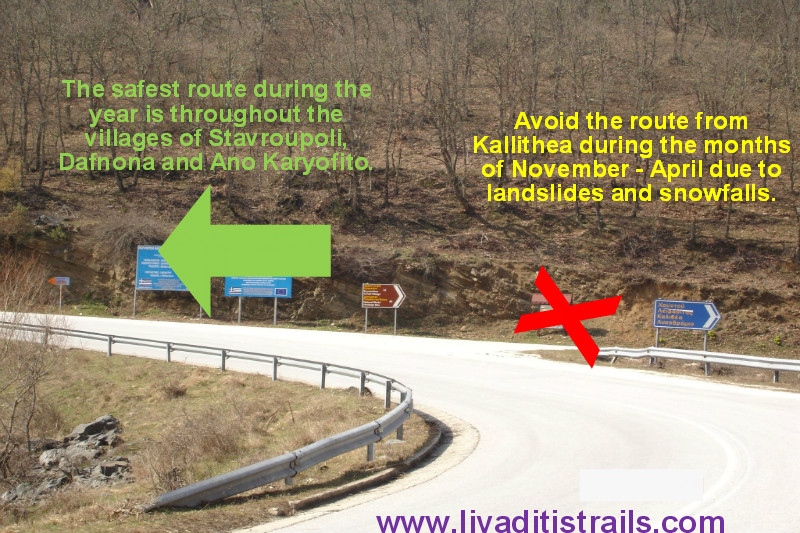 Picture 1.
Livaditis is the highest mountain village of Xanthi with only 8 residents (Picture 2).
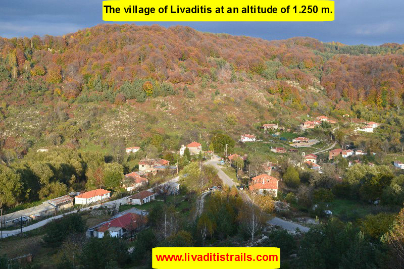 Picture 2.
Right after Livaditi (8 km), you will arrive at the Erymanthos Forest Village (altitude 1.315m.).There, the asphalt road ends and a cluster of rural roads begins, where each one has a different destination. Therefore, you start walking on the last street on your left hand (Picture 3).
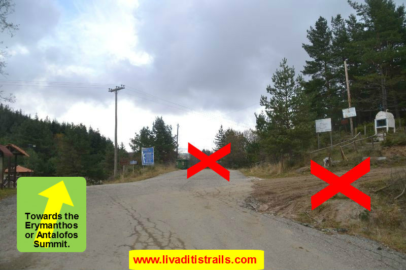 Picture 3.
At about 500 meters and at an altitude of 1350 meters, you will come across an intersection on your left hand. Follow the road uphill (Picture 4).
 Picture 4.
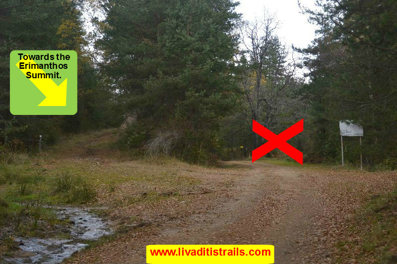
After walking for about 450 meters and at an altitude of 1,375 meters, the road opens in two directions, left and right. Take the right fork in the road. Please be aware that you can cross this road using a 4x4, but only up to this point, since it has many deep holes because of the many rainfalls, making its crossing no longer possible. After continuing your walk for another 450 meters, you will arrive at the right corner, from which the signaling starts (this is a horizontal red line between two white ones). Such signs are obvious on rocks and mainly on trees throughout the rest of the road, i.e. for another 1 km and 280 meters (the total distance of the rural road from the Forest Village is 3 km and 180 meters) (Picture 5).
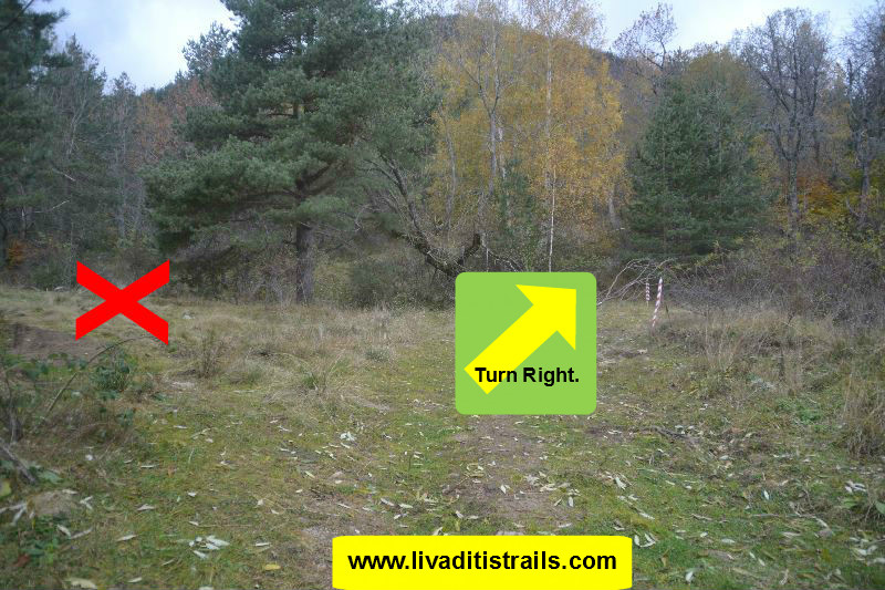 Picture 5.
Once you cover this distance, the road leads to a dead end and you will find four signs and marking tapes, which start from the end of the road and lead left to the slopes, signaling the start of the trail at an altitude of 1,480 meters (Picture 6).
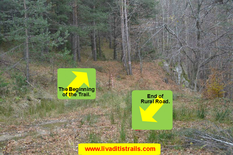 Picture 6.
You can have in your mind the path as follows: At the first 10 minutes you go through the first 310 meters and from the first sign the path goes straight ahead and uphill. Once you cross a small opening (like a small valley), you will pass some big and tall pines and you turn right and continue for another 5 minutes in the same direction, covering 110 meters and thus reaching the base of a slope, at an altitude of 1,520 meters (Picture 7).
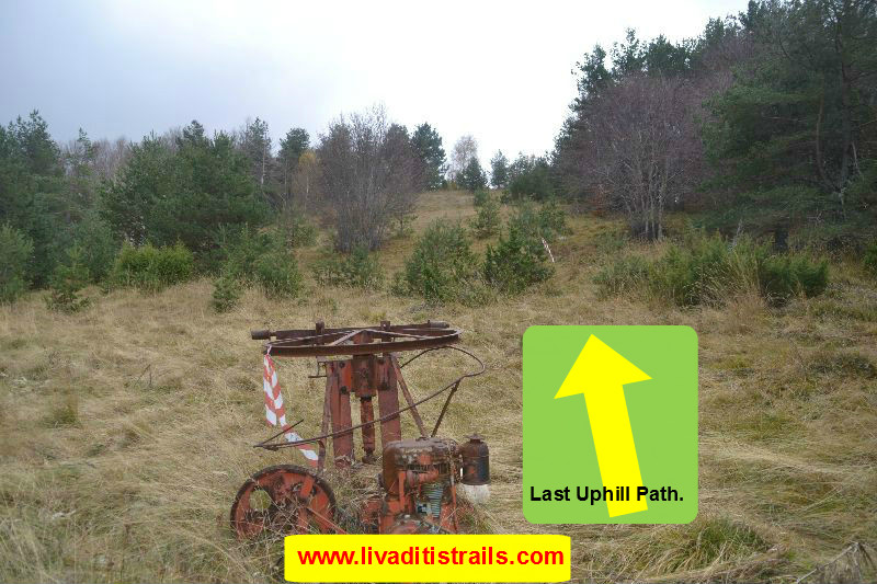 Picture 7.
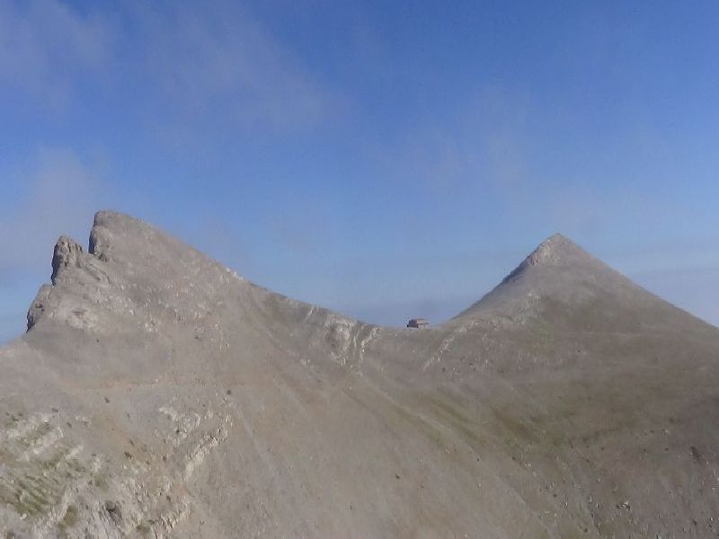
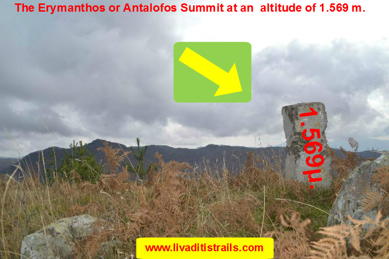
The end of this slope leads you to the Erymanthos Summit (known as the Antalofos Summit) at an altitude of 1,569 m., after15 minutes and 45 meters height and 200 meters mileage (Picture 8).
 Picture 8.
This trail is a short and pleasant journey, lasting about an hour and 30 minutes (it is thus a walking distance on a rural road for 3 km and 180 meters and another 620 meters on a more pleasant path). It is a very well signposted trail and there is no fear of getting lost ... As for the view and the beauty that you face from up there, it cannot be described in words ...Carry with you some coffee, sweat it out a bit more and enjoy your coffee at the best and most beautiful cafe that is actually... the N A T U R E!!!
The passage of the trail occured on Sunday 19th of January 2014, the same day we gathered all the information that was mentioned, as well as the photographs included in the narrative of the path. We consider ourselves responsible, so we would like to treat those who love Nature and hiking and enjoy learning about new places with the same responsibility. We would also like, if you cross the trail above or any other on our website, to contact us (email: This email address is being protected from spambots. You need JavaScript enabled to view it.) whether we were accurate on our description or there was a flaw that should be corrected.
Thank you for your trust and for visiting our website.