")
Route length: 15,5 km.
Duration: 7 hours.
Altitudinal slope: Ascent: 1.062 meters Descent: 1.240 meters.
Route description: Circular Ascent-Medium difficulty.
Recommended to: All mountaineering clubs, as well as individuals with certain experience in mountain trails.
Season: All year around, on condition that there is no snow.
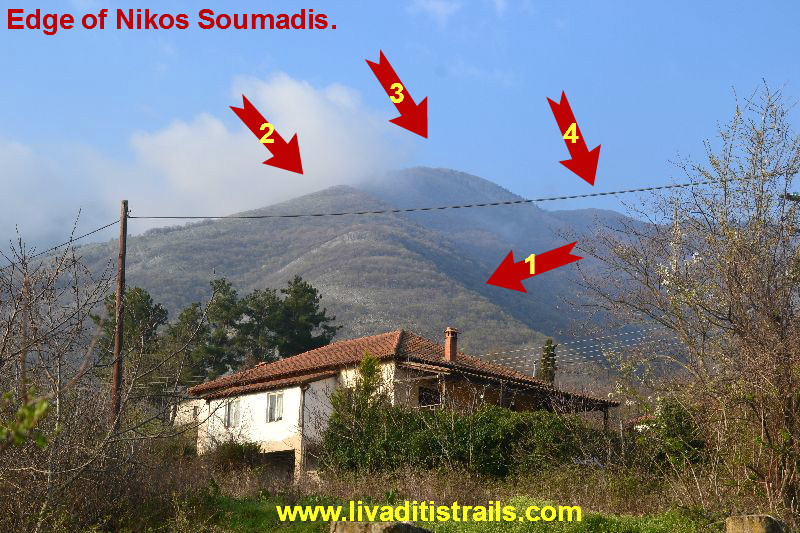
A circular route, which is considered the “baptism of fire” for beginner climbers and hikers, due to the large gradient until the summit. It is a gift from a person who dedicated his life to the mountains and left as assets many mountain trails in the country. Nikos Soumadis has left his mark on most of the mountains in the district and many others across the country. All we must do, is preserve his legacy and at least maintain and bring out the routes he offered us. This particular route, after our co- citizens’ recommendations, can be named “Edge of Nikos Soumadis” as a small recognition of the work he offered to climbing. The route starts from the mountain settlement of Gerakas, ascents to the summit of Agios Georgios commonly known as Tsal and through the mountain settlement of Pillima, ends up again at Gerakas.
General Informations:
It is a route of 15 km and 500 meters’ total length - more specifically 2 km and 700 meters of dirt road, 1 km and 460 meters of concrete road (the road that goes through the villages) and 11 km and 340 meters of path. The duration of the trail is about 7 hours. There are orange clothes and red signs on trees and rocks to mark the trail. You should be very careful of the large slope of the route and the fact that there is water only an hour away before you reach the mountain settlement of Pillima. There is phone service all the time through the path. In general, it is considered a trail of medium difficulty and can be also crossed by individuals with certain experience in mountain hiking.
USEFUL PHONE NUMBERS:
European Emergency Number: 112
Fire Brigade: 199 E.K.A.V.
(Ambulance Help): 166
All the above are summarized in the following chart:
Click on the word “Wikiloc” at the upper right corner of the map to store the route on your Garmin gps device or Androit or Smartphone device. You can also print the information without the illustrations shown below. The tracking of the trail was done using a 650t Montana gps device by Garmin
The translation in English was made by " Sidiropoulou Athina " and we thank her, for her help.
In particular:
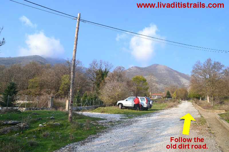
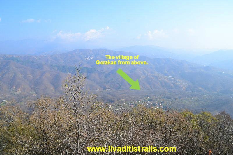
Starting from Xanthi, follow the old Xanthi-Drama Highway (the road to Stavroupoli). 12 km later, you will see a crossroad on your left which leads to the mountain settlement of Gerakas. Turn and 3 km later, after you have driven through the village, you will reach the last houses at an altitude of 365 meters, where you can park your car and start hiking…Are you ready? (Picture 1)...
 Picture 1.
This is your last chance to reconsider. In 3 km and 880 meters you will have ascended 1.062 meters of altitude…Really tiring, isn’t it? It’s ok though… Get off your car without thinking about it. Every step of this path worths the sweat you will shed. Think of it as a new experience. You will also be lucky to enjoy a glass of tsipouro and even feel its density. You are probably convinced as you are getting of your car. Are you ready? Take a deep breath and start. We won’t join you though; we will be watching you from afar with binoculars (Picture 2)...
 Picture 2.
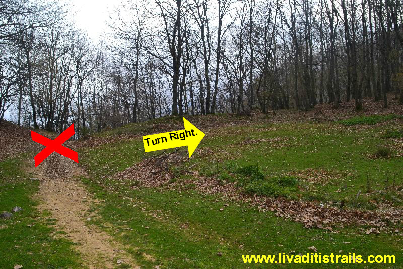
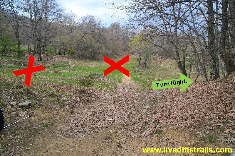
For the first 300 meters, you will walk on the old dirt road, which is nearly closed and looks like a path. After 10 minutes, you will reach a crossroad of paths at an altitude of 415 meters; the left route leads back to Gerakas, the route straight ahead takes you to the settlement of Pillima while the right route, which is marked by orange clothes hanged on trees starting from this point, is the one you should follow (Picture 3)...
 Picture 3.
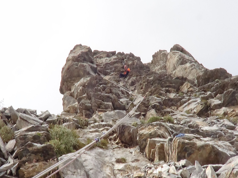
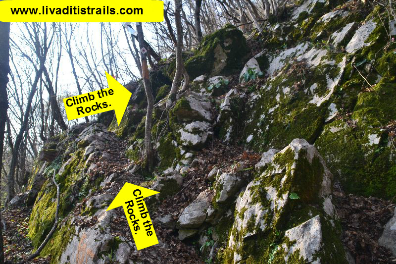
You will be walking through an oak forest feeling carefree and thinking how beautiful and easy the route will be if it continues like this and that in the end you will manage to cross it. No way!! Suddenly, you will see from far away a rock in your way, where the signs lead you, with no possibility of going right or left, only up. It’s like it had been planted there and as the signs indicate you will have to climb it. Hang in there… No more talking or joking… You had better start thinking about the tsipouro we mentioned earlier and remember that every step you take brings you closer to achieve your first MANLY CROSSING. Remember what we have just told you (Picture 4)...
 Picture 4.
Every step you will be making from now on, due to the altitudinal gradient, means that you will be ascending for at least a meter of altitude. The more you ascend the more amazing the view will be. It feels like being on a plane (Picture 5)...
 Picture 5.
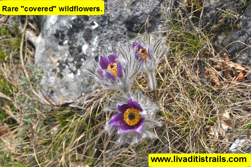
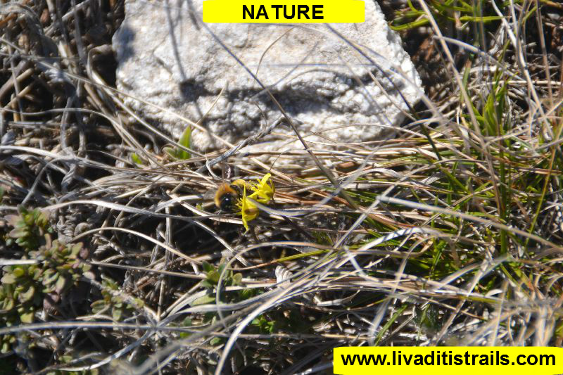
It is indeed a remarkable work of Nature. To protect all species of plants from people and the weather conditions, it gives them the chance to observe from far away the poor world that we, the superior beings, created. These “covered” wildflowers are rare to come across (Picture 6)...
 Picture 6.
For the next hour, the only thing you need to be concerned about is the gradient. The route you are walking on is well-signed by Nikos Soumadis with red paint on trees and rocks, while on the branches there are orange clothes placed a few months earlier (January 2016) by Dimosthenis Athanasiadis and his friends (Picture 7)...
 Picture 7.
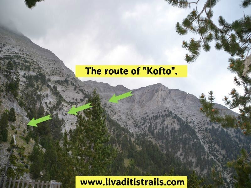
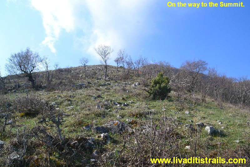
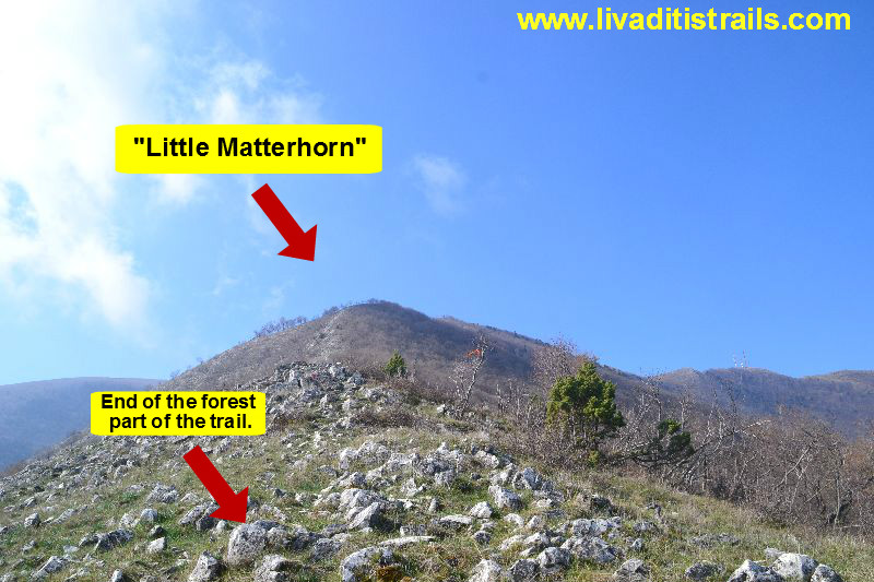
2 km later at an altitude of 890 meters from where you have parked your cars and in about 1/1,5 hours (an hour and a half) you will have crossed the forest part of the trail. You finally have in front of the clear horizon; so, what do you see? The ascent that lays straight ahead. The last edge, which was named “Little Matterhorn”, may be even harder. It winks at you and dares you to make a final exceedance (Picture 8)...
 Picture 8.
You will need about 20 minutes to go through the last obstacle…and from now on everything will be easier. The summit in the distance is good news… you are getting closer and you will definitely feel relieved from the great effort (Picture 9)...
 Picture 9.
When you have such a pleasant view in front you, you realise that there is also another way of life on this “planet” (Picture 10)...
 Picture 10.
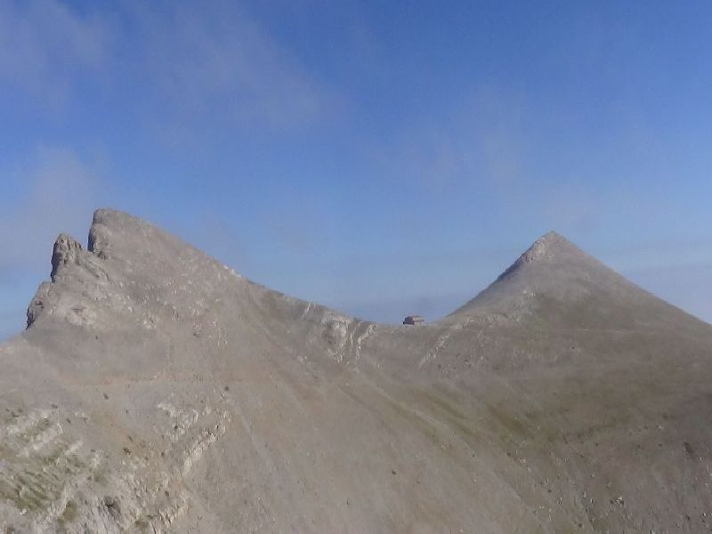
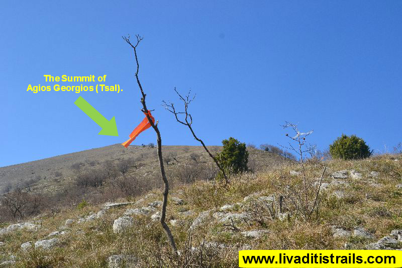
As soon as you have ascended the “little Matterhorn”, you will probably need about 60-70 minutes to reach the summit, which may be noticeable but it will give you a hard time. Of course, this is something that you will overcome easily by the time you reach the weathering landmark at an altitude of 1.402 meters (Picture 11)...
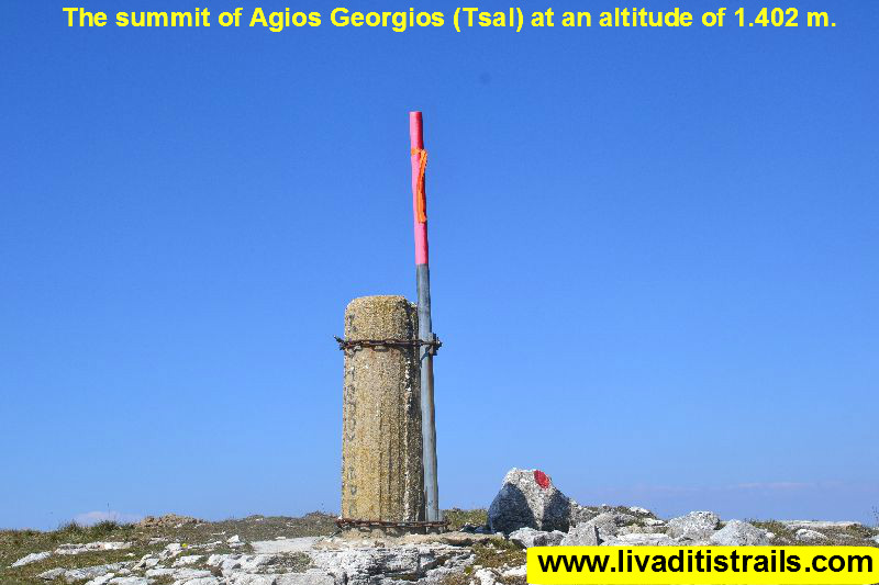 Picture 11.
Don’t forget that the wind on the summit is very strong, especially during the winter months when the cold is more severe at this height. Not even bugs can survive this cold that’s why they gather to endure it (Picture 12)...
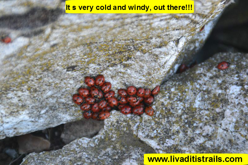 Picture 12.
A little further down from the summit you can find a place known as studio, where you can be protected by the wind or have the chance to change your clothes, drink some coffee or gain your strength back by eating some of the food you packed (Picture 13)...
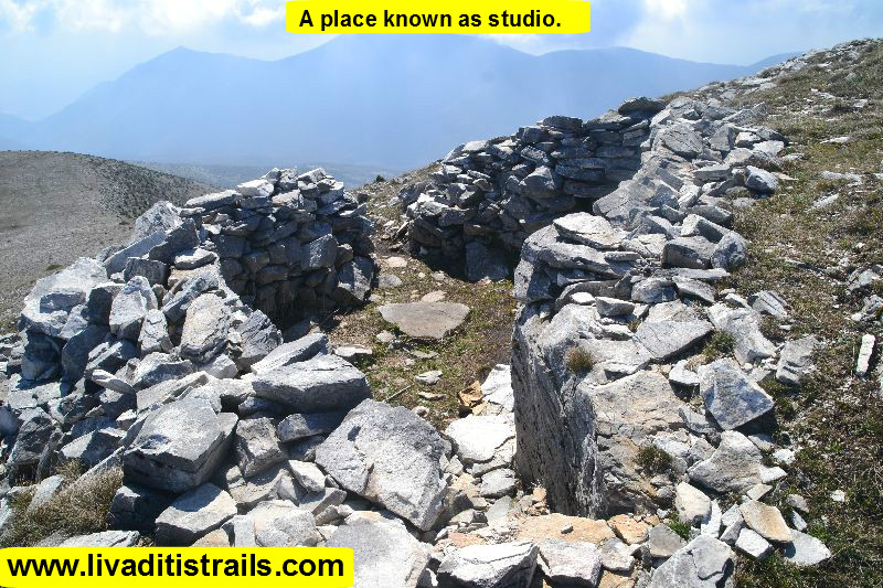 Picture 13.
After getting some rest, prepare yourselves to continue today’s adventure. The returning path (starting straight down from the studio) is well-signed with red marks on rocks and bushes (Picture 14)...
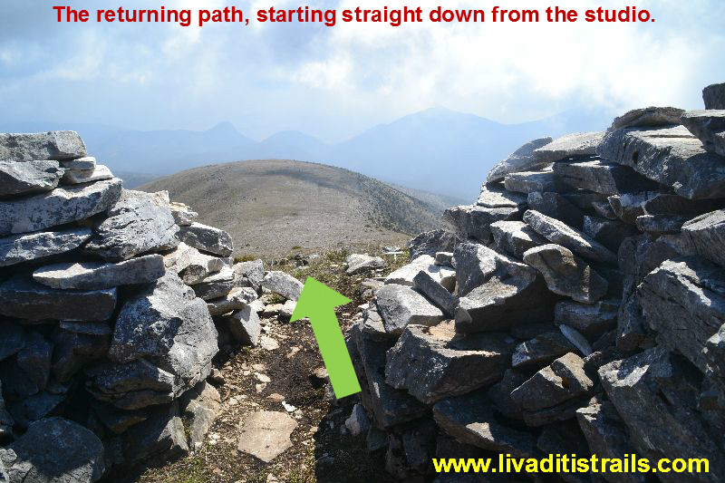 Picture 14.
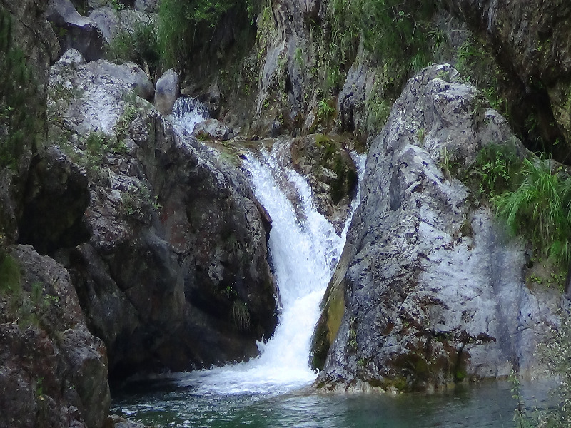
For the next hour and a half, the path is descending with great slope on rocky terrain. You descend to 590 meters and you have walked 4 km and 720 meters. You will come across the country road which comes from the settlement of Pillima and ends up to a pen at the settlement of Makario (Makaklar). At the crossroad, you will see the only water trough on the path with running water. Turn left and continue walking on the country road (Picture 15)...
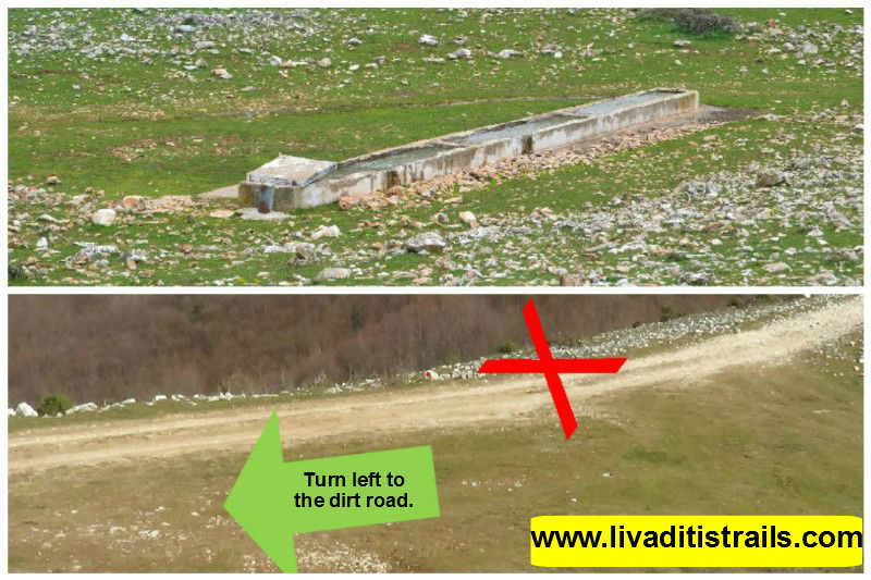 Picture 15.
Continue walking on the country road for another 3 km and 100 meters for about 50 minutes and you will arrive at the settlement of Pillima at an altitude of 315 meters. You have now crossed the largest part of the trail. We recommend you a little stop at the tavern of the village, named “Pillima” (tel. number 2541024242) either for some coffee or juice or to finish your expedition and get some rest eating and enjoying the wonderful cuisine (Picture 16)...
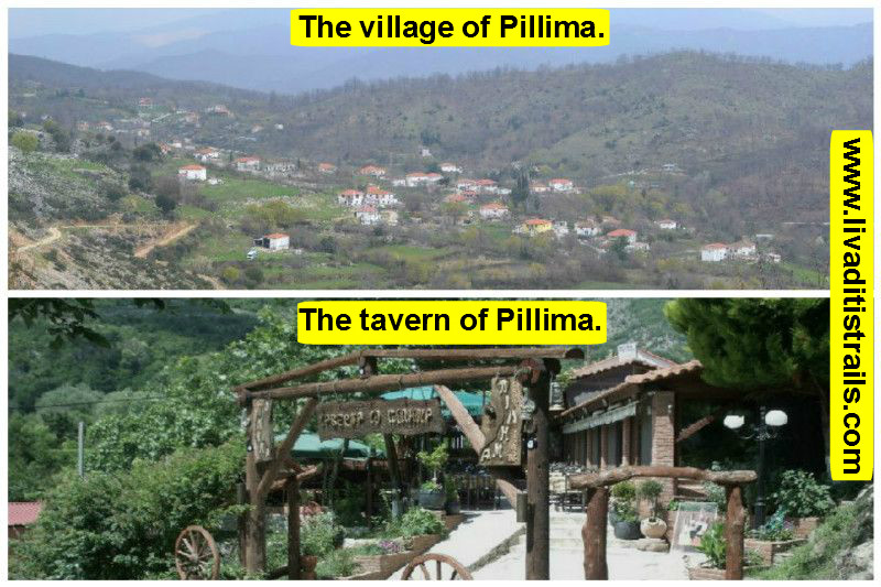 Picture 16.
For the rest of you who wish to continue your course, let’s keep up with the description: right outside the tavern continues the village road which you must follow until you reach the last houses, for another 1 km and 60 meters. You will arrive at a fenced plot on your right, at an altitude of 400 meters, while the country road you have crossed turns left. Don’t turn but continue straight ahead and a little to the left to the stream (Picture 17)...
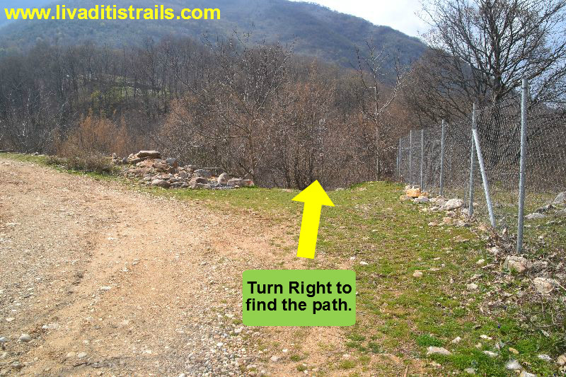 Picture 17.
From this point the path will lead you back to the settlement of Gerakas, after 1 km and 480 meters in 25 minutes. This astonishing path we recommend, can also be crossed by families with children due to its easy access and the lack of technical difficulties. You will end up again at the first crossroad, where you started to ascend to the mountain. So, the route is already familiar, only this time you will have to turn right below (through the woods) to arrive at your parking space (Picture 18)...
 Picture 18.
5 minutes later you will reach the final point of today’s adventure. In our humble opinion, you will find it necessary to make a stop for some coffee or food at the foothill of this difficult mountain in the District of Xanthi, because it will help you realise the size and the difficulty of this first “manly route” you have just crossed. 15,5 km in 7 hours at an altitudinal difference of 1.062 meters isn’t something that can be done every day or by anyone. After all, we believe you deserve to break away a little from your food habits. - Generally about the route The rocky terrain you will cross through the trail may have hidden surprises like snakes which can be seen closely. Because of their presence, the route may be considered difficult, especially during summer, that’s why we recommend you to cross it from October to May. Also, the lack of water springs with potable running water is another problem of the route you will have to deal with. The passage of the trail occurred on Sunday 20th March 2016, the same day we gathered all the information that was mentioned, as well as the photographs included in the narrative of the path. We consider ourselves responsible, so we would like to treat those who love Nature and hiking and enjoy learning about new places with the same responsibility. We would also like, if you cross the trail above or any other on our website, to contact us (e-mail: This email address is being protected from spambots. You need JavaScript enabled to view it.) whether we were accurate on our description or there was a flaw that should be corrected.
Thank you for your trust and for visiting our website.